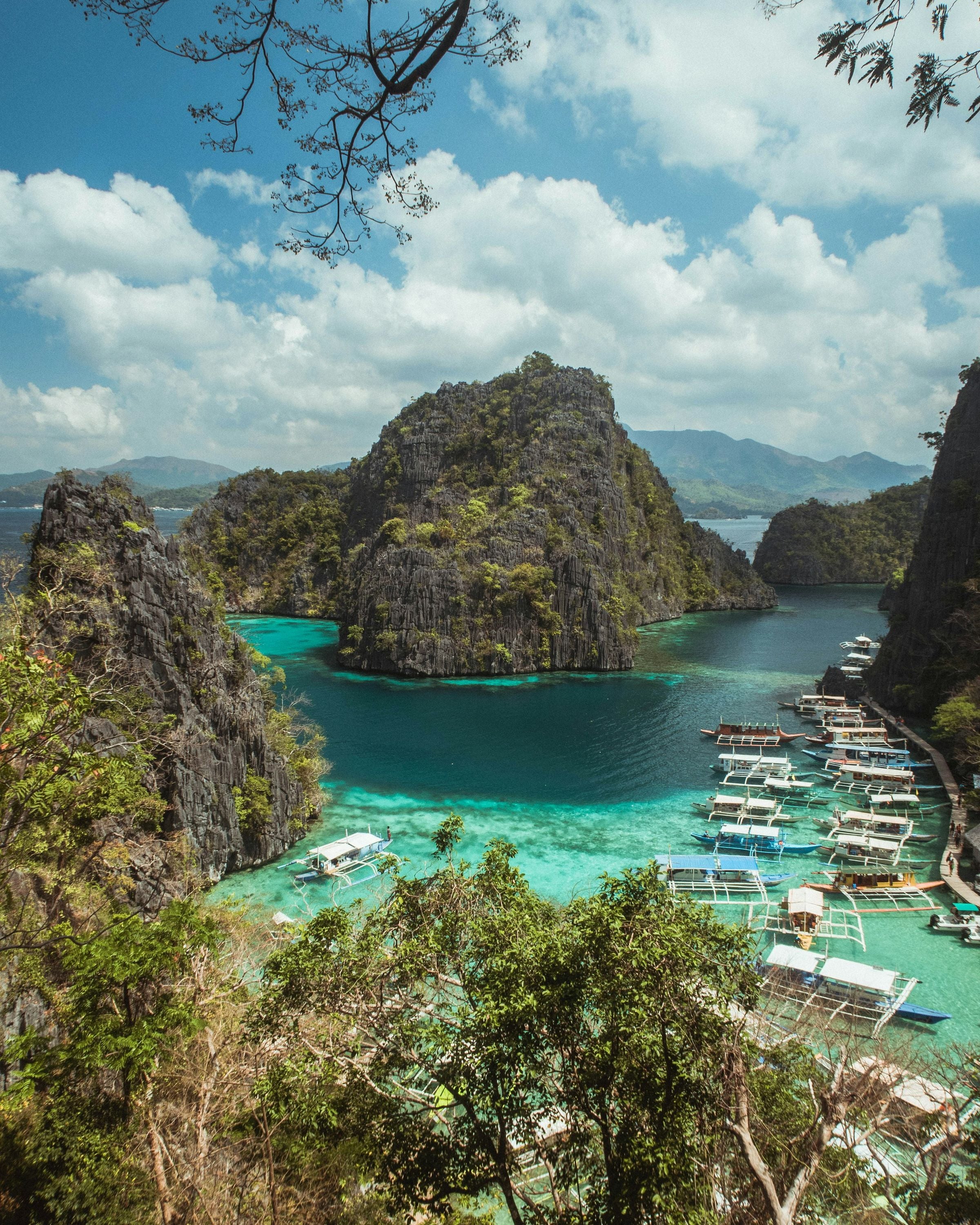
Coron covers the eastern part of Busuanga Island, all of Coron Island and about fifty smaller islands reaching from Tara Island in the northeast to Canipo Island in the south, in the Calamian group between the South China Sea and the Sulu Sea.
Municipality of 23 barangays, 689.1 km² of land.
Coron covers the eastern part of Busuanga Island, all of Coron Island and about fifty smaller islands reaching from Tara Island in the northeast to Canipo Island in the south, in the Calamian group between the South China Sea and the Sulu Sea.
The municipal tourism office counts 34 natural attractions, 15 of them on Coron Island, which the Tagbanua manage as their ancestral domain. On the Busuanga side, Mt. Tapyas above the town is a common sunset walk. The Coron Island Natural Biotic Area is on the Philippines' tentative list for UNESCO World Heritage.
Around Coron
Coron is a wreck-diving destination: about a dozen sunken Japanese warships lie at depths of 10 to 40 metres.
Coron is the commercial capital of the Calamian Islands.
Island
Coron Island
Third-largest island of the Calamian Islands, forming the eastern side of Coron Bay. It makes up two of Coron's barangays, Banuang Daan and Cabugao.
Nature
Barracuda Lake
Lake on Coron Island, also called Luluyuan, where the water warms with depth to more than 38 °C, producing thermoclines.
Reef
Siete Pecados Marine Park
Marine protected area around a group of seven rocky islets off Coron. It received a Blue Park Award from the Marine Conservation Institute in April 2024.
Mountain
Mt. Tapyas
Mountain in Coron climbed by more than 700 steps to its peak. It is a site for the Stations of the Cross during Holy Week.
Nature
Maquinit Hot Spring
Hot spring near Siete Pecados whose salty, heated water collects in pools built by the owners. It can be reached by boat when the tide is high.
Beach
Banol Beach
Beach on Coron Island, the island that forms the eastern side of Coron Bay.
A short history
The Spanish named the place Peñon de Coron, after the Tagbanua word corong, a kind of pot. In 1998 Coron Island was recognised as a Tagbanua ancestral domain.
On 24 September 1944 more than a hundred American aircraft attacked the Japanese ships sheltering around Coron; the wrecks left in the bay are what draws many divers today.
The Kasadyaan Festival falls on the feast of Saint Augustine, the town's patron, on 28 August, with masses and processions alongside street dancing by schools and local groups.
The way in
Manila
From Manila: Fly to Francisco B. Reyes Airport in Busuanga (about 1 to 1.5 hours from Manila; flights also from Cebu and Clark), then 30 to 45 minutes by van to Coron town. By sea, 2GO and Atienza Inter-Island Ferries sail from Manila to Coron, about 13 hours.
Coron
Nearest gateway. Francisco B. Reyes Airport (USU) in Busuanga, with Coron's own port for ferries from Manila
A place in Coron
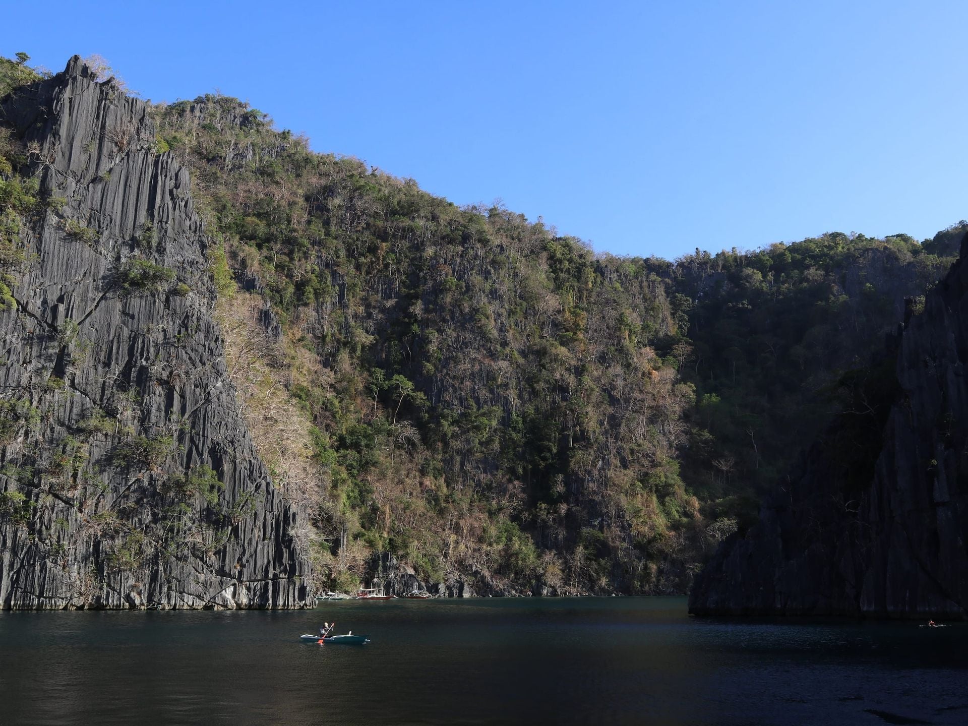 11°57′N 120°13′ETwin LagoonLagoons and lakes
How to get there. By boat from Coron town on a Coron Island tour; it lies not far from Kayangan Lake on the same island
Best time. December to April, when seas are calmest for boat tours
11°57′N 120°14′E
Kayangan Lake
Lagoons and lakes
How to get there. By boat from Coron town on an island-hopping tour, then a short climb over the ridge to the lake
Best time. December to April, when seas are calmest for boat tours
Before you go
Fees, rules and schedules change. Check them with the town.
- Official website
- Municipality of Coron
- Tourism office
- Coron Tourism
- Local government
- Municipality of Coron
- Sources
Sources (13)
- PSGC code 1705309000 and 23 barangaysPSGC API, data from the PSA Philippine Standard Geographic Code (psgc.gitlab.io; release not stated by the mirror, counts cross-checked with psgc.cloud and PhilAtlas)
- Land area 689.1 km² (PSA 2013 figure) and barangay countCoron, Palawan Profile, PhilAtlas
- 34 natural attractions, 15 on Coron Island managed by the Tagbanua; Mt. Tapyas; Kasadyaan Festival on the feast of Saint Augustine, 28 AugustCoron Tourism, Municipality of Coron
- Extent of the municipality; UNESCO tentative list; name origin; ancestral domain recognition 1998; air raid of 24 September 1944; served by Francisco B. Reyes AirportCoron, Palawan, Wikipedia
- Flight times to Francisco B. Reyes Airport, airport to town transfer time, Manila to Coron ferriesHow To Get Here, Municipality of Busuanga
- Coron is a wreck-diving destination: about a dozen sunken Japanese warships lie at depths of 10 to 40 metres.Coron, Palawan - Wikipedia
- Coron is the commercial capital of the Calamian Islands.Coron, Palawan - Wikipedia
- Coron IslandCoron Island - Wikipedia
- Barracuda LakeCoron Island - Wikipedia
- Siete Pecados Marine ParkSiete Pecados - Wikipedia
- Mt. Tapyas48 Hours in Coron, Palawan: A 'Biyahe ni Drew' itinerary (GMA News)
- Maquinit Hot SpringA grand view of Coron (The Philippine Star, 2014)
- Banol BeachCoron Island - Wikipedia