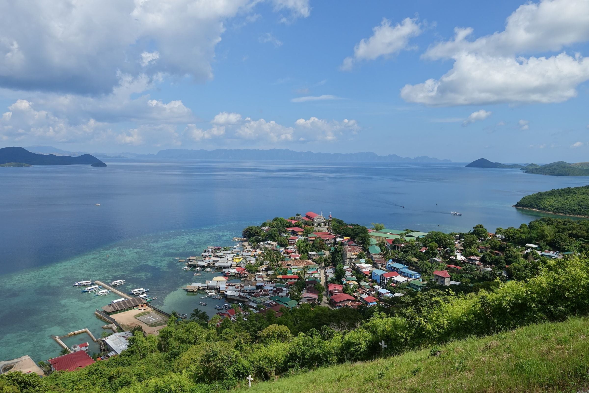
Culion is made up mainly of Culion Island and some forty smaller islands in the Calamian group, with Busuanga Island to the north, the Coron reefs to the east and Linapacan to the south. For most of the twentieth century the island was a leprosy colony. It became a municipality of its own under Republic Act No. 7193, dated 19 February 1992, and in 2006 the World Health Organization declared it free of leprosy.
Municipality of 14 barangays, 499.59 km² of land.
Culion is made up mainly of Culion Island and some forty smaller islands in the Calamian group, with Busuanga Island to the north, the Coron reefs to the east and Linapacan to the south. For most of the twentieth century the island was a leprosy colony. It became a municipality of its own under Republic Act No. 7193, dated 19 February 1992, and in 2006 the World Health Organization declared it free of leprosy.
Around Culion
Culion was a leper colony from 1906 and once sheltered one of Asia's largest populations of people with leprosy, between 3,500 and 4,000.
The Culion Leprosy Archives were inscribed in 2018 on UNESCO's Memory of the World Register for Asia and the Pacific.
Heritage
Culion Museum and Archives
Museum in the former laboratory building of the Culion leper colony, inside the Culion Sanitarium and General Hospital compound. It was declared a National Cultural Treasure in 2024.
Heritage
Fort Culion
Spanish-era citadel built in 1740 by the Recollect Augustinians for defence. It is now in ruins, serves as a lighthouse, and its cannons are still visible.
Heritage
Immaculate Conception Church (Culion Church)
Parish church in Culion proper whose walls the Jesuits built with coral stones taken from Fort Culion.
A short history
The colony opened in 1906, when the American administration brought the first 370 patients from Cebu; by 1910 more than five thousand people had been sent to the island. Its records, kept at the Culion Museum and Archives, were inscribed on UNESCO's Memory of the World Register for Asia and the Pacific in 2018.
The Tagbanua are the island's first people. Barangay Carabao was created for the Tagbanua community under Republic Act No. 9032 in 2001. The Spanish left a church and fort at Libis, built around 1670 as a defence against raids.
Before you go
Fees, rules and schedules change. Check them with the town.
- Official website
- Municipality of Culion
- Facebook page
- Culion Municipality on Facebook
- Local government
- Municipality of Culion
- Sources
Sources (9)
- PSGC code 1705322000 and 14 barangaysPSGC API, data from the PSA Philippine Standard Geographic Code (psgc.gitlab.io; release not stated by the mirror, counts cross-checked with psgc.cloud and PhilAtlas)
- Land area 499.59 km² (PSA 2013 figure) and barangay countCulion, Palawan Profile, PhilAtlas
- Island composition and boundaries; leprosarium from 1906; first 370 patients from Cebu; 5,303 patients 1906 to 1910; RA 7193 of 19 February 1992; WHO declaration 2006; Memory of the World Register 2018; Tagbanua and Barangay Carabao under RA 9032; fort at Libis about 1670Culion, Wikipedia
- Official municipal Facebook page linked from the LGU siteCulion Municipality, official website
- Culion was a leper colony from 1906 and once sheltered one of Asia's largest populations of people with leprosy, between 3,500 and 4,000.Culion leper colony - Wikipedia
- The Culion Leprosy Archives were inscribed in 2018 on UNESCO's Memory of the World Register for Asia and the Pacific.Culion - Wikipedia
- Culion Museum and ArchivesCulion Museum and Archives - Wikipedia
- Fort CulionFort Culion - Wikipedia
- Immaculate Conception Church (Culion Church)Fort Culion - Wikipedia