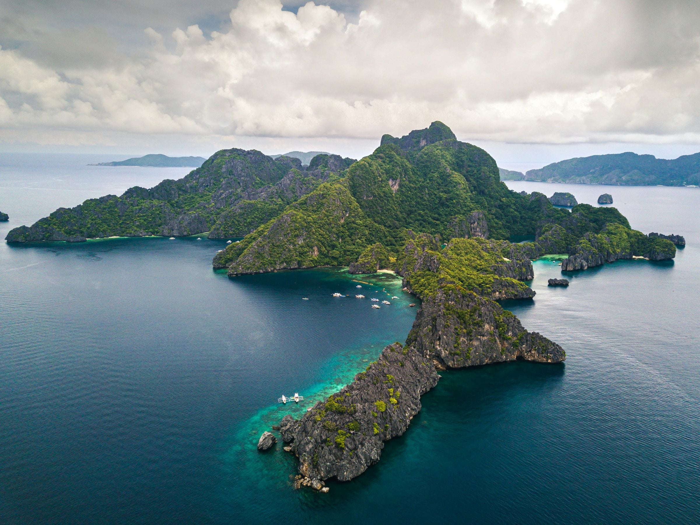
El Nido sits at the northern tip of mainland Palawan, on Bacuit Bay, and is the way into the Bacuit archipelago of limestone islands, white-sand beaches and coral reefs. Its marble and limestone cliffs are nesting grounds for swiftlets, whose edible nests gave the town its name.
Municipality of 18 barangays, 923.26 km² of land.
El Nido sits at the northern tip of mainland Palawan, on Bacuit Bay, and is the way into the Bacuit archipelago of limestone islands, white-sand beaches and coral reefs. Its marble and limestone cliffs are nesting grounds for swiftlets, whose edible nests gave the town its name.
The town and parts of neighbouring Taytay form the El Nido-Taytay Managed Resource Protected Area, declared in 1998 and covering about 903 km², some 40 percent land and 60 percent sea. Island trips leave from the town's beaches and the Philippine Ports Authority port at Buena Suerte.
Around El Nido
El Nido, formerly Bacuit, is named after the edible swiftlet nests in its limestone cliffs, the main ingredient of nido soup.
Island
Cadlao Island
An island in El Nido that holds the municipality's highest peak.
Heritage
Ille Cave
An archaeological site in a karst tower at New Ibajay, in Dewil Valley; excavations since 1998 have recovered human burials and thousands of artifacts.
Beach
Entalula Beach
A beach in El Nido backed by limestone cliffs and reached only by boat; first on the World's 50 Best Beaches list for 2026, second in 2025.
Nature
Small Lagoon
A lagoon in El Nido where, in 2018, the El Nido-Taytay protected-area management board limited visits to 30 guests at a time and 15 kayaks.
Island
Miniloc Island
An island in El Nido's Bacuit Bay, home to Miniloc, the first resort opened by El Nido Resorts.
A short history
People have lived around Bacuit Bay since at least 2800 BC, and finds in the Dewil Valley may be some 14,000 years old. The town grew from Talindak, a Tagbanua village, and the Tagbanua of the area still keep much of their culture.
The Spanish called the place Bacuit. In 1954 Republic Act No. 1140 renamed it El Nido, after the swiftlet nests in its cliffs. Coconut, rice, cashew, banana and mango are its main farm products.
The way in
Manila
From Manila: Fly to El Nido Airport, about 4 km from town, where routes are run by Cebu Pacific's regional arm Cebgo since it took over AirSWIFT's flights in July 2026; or fly to Puerto Princesa and continue by road. From Coron, fast ferries take about 3.5 hours.
Puerto Princesa
From Puerto Princesa: Vans leave from Puerto Princesa airport and the San Jose terminal; the ride north takes about 6 to 7 hours.
El Nido
Nearest gateway. El Nido Airport (Lio), Barangay Villa Libertad, about 4 km from town; Puerto Princesa International Airport by road
Places in El Nido
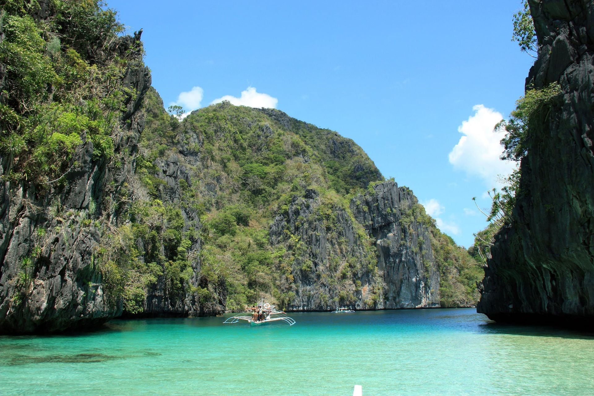 11°09′N 119°19′EBig LagoonLagoons and lakes
How to get there. By island-hopping boat (El Nido Tour A) from El Nido town to Miniloc Island, then by kayak through a shallow channel into the lagoon
Best time. December to May, during the dry season and calmer seas
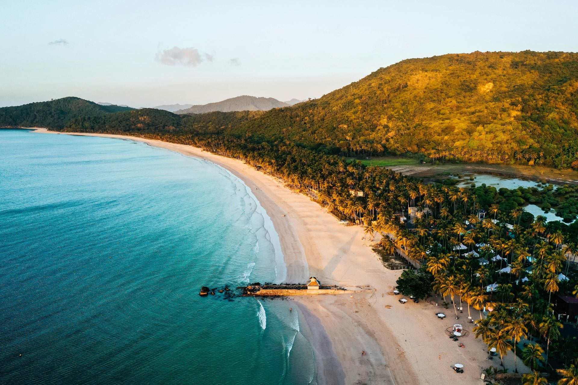 11°19′N 119°26′ENacpan BeachBeaches
How to get there. By tricycle, van or motorbike from El Nido town, about 17 km and 45 minutes on a paved and partly unpaved road to Barangay Bucana
Best time. November to May, dry season
Before you go
Fees, rules and schedules change. Check them with the town.
- Official website
- Municipality of El Nido
- Local government
- Municipality of El Nido
- Sources
Sources (12)
- PSGC code 1705312000 and 18 barangaysPSGC API, data from the PSA Philippine Standard Geographic Code (psgc.gitlab.io; release not stated by the mirror, counts cross-checked with psgc.cloud and PhilAtlas)
- Land area 923.26 km² (PSA 2013 figure) and barangay countEl Nido, Palawan Profile, PhilAtlas
- Gateway to the Bacuit archipelago; swiftlet nests and the name; protected area of 1998, 903.21 km², 40% land and 60% sea; PPA port at Buena Suerte; prehistory of Bacuit Bay and Dewil Valley; Talindak; RA 1140 of 1954; farm productsEl Nido, Palawan, Wikipedia
- El Nido Airport in Barangay Villa Libertad, about 4 km from the town centreEl Nido Airport, Wikipedia
- Cebgo assumed operation of all AirSWIFT flights from 1 July 2026AirSWIFT, Wikipedia
- Vans from Puerto Princesa airport and San Jose terminal, about 6 to 7 hours; ferries from Coron about 3.5 hours (page updated 31 August 2026)How to get to El Nido: flights, vans and boats from Puerto Princesa, VisitPalawan
- El Nido, formerly Bacuit, is named after the edible swiftlet nests in its limestone cliffs, the main ingredient of nido soup.El Nido, Palawan - Wikipedia
- Cadlao IslandEl Nido, Palawan - Wikipedia
- Ille CaveIlle Cave - Wikipedia
- Entalula BeachEl Nido's Entalula Beach named world's best beach for 2026 - Palawan News
- Small LagoonDENR regulating El Nido tourist influx - Philstar
- Miniloc IslandLife's more than a beach at Miniloc - Philstar