Mt. Mantalingahan Protected Landscape
At 2,085 metres, Mt. Mantalingahan is Palawan's highest peak, and its range forms the core of the Mt. Mantalingahan Protected Landscape, declared under the National Integrated Protected Areas System in 2009 and spanning the towns of Rizal, Quezon, Bataraza, Brooke's Point and Sofronio Espanola.
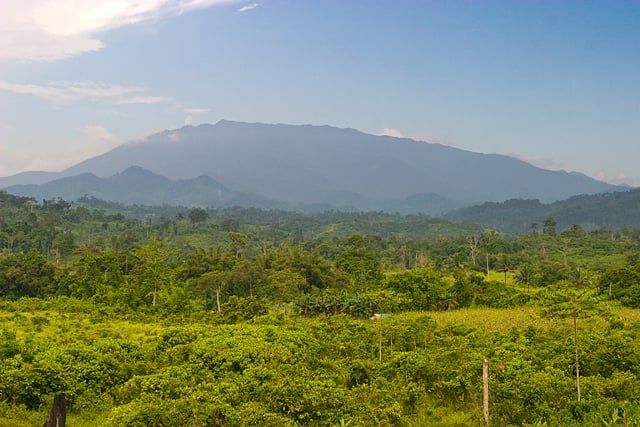
The protected landscape shelters mossy forest, pitcher plants and wildlife found only on Palawan, and its slopes feed rivers used by farming communities across the province's south.
Reaching the summit is a serious multi-day trek, typically four days, starting from Barangay Ransang in Rizal and exiting near Brooke's Point, with DENR and barangay permits required and a local guide mandatory.
Nearby
Sources (3)
- Mt. Mantalingahan rises to 2,085 m, the highest peak in Palawan; the protected landscape was declared by Proclamation No. 1815, s. 2009 under the NIPAS Act, covering Bataraza, Brooke's Point, Sofronio Espanola, Quezon and RizalProclamation No. 1815, s. 2009
- Summit coordinates approximately 8.81833 N, 117.66972 EMount Mantalingajan, Wikidata (Q1950593)
- Typical trek is a 4-day traverse starting at Barangay Ransang, Rizal, exiting at Barangay Malis, Brooke's Point; DENR and barangay permits required; rated among the most difficult treks in the PhilippinesMt. Mantalingahan Traverse